We had a dry winter, but April brought a bucketload of water to our snowpack. What does that increased Snow Water Equivalent (SWE) mean for our rafting season?
While our January felt more like JUNE-uary and February and March followed suit with warmer-than-usual temperatures, the month of April brought us the snow we were craving. We don’t pay attention to snow levels just to know if we should go skiing or snowboarding, but also so that we can make some predictions about what our rafting and kayaking season might look like. In short, snow is water and water means rafting!
Rivers collect water from their watersheds – little creeks merge into larger creeks, which merge into larger creeks, and so on until they become full-on rivers. Where this water comes from differs from watershed to watershed but can include glaciers, springs, rain, and snowpack. A river can be fed by one or all of these sources, and those sources give each river some of its own unique characteristics.
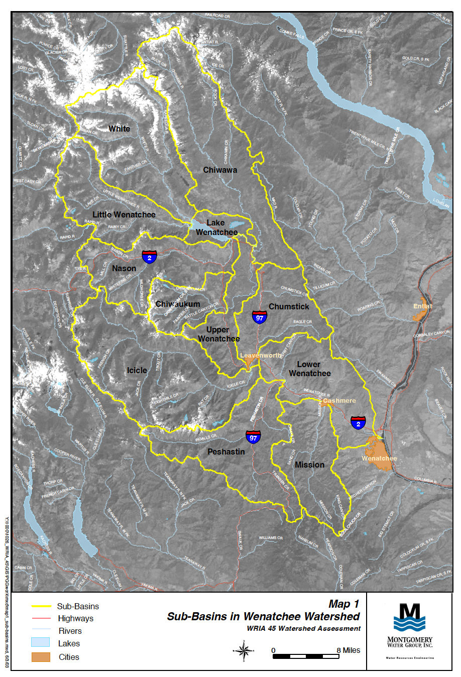
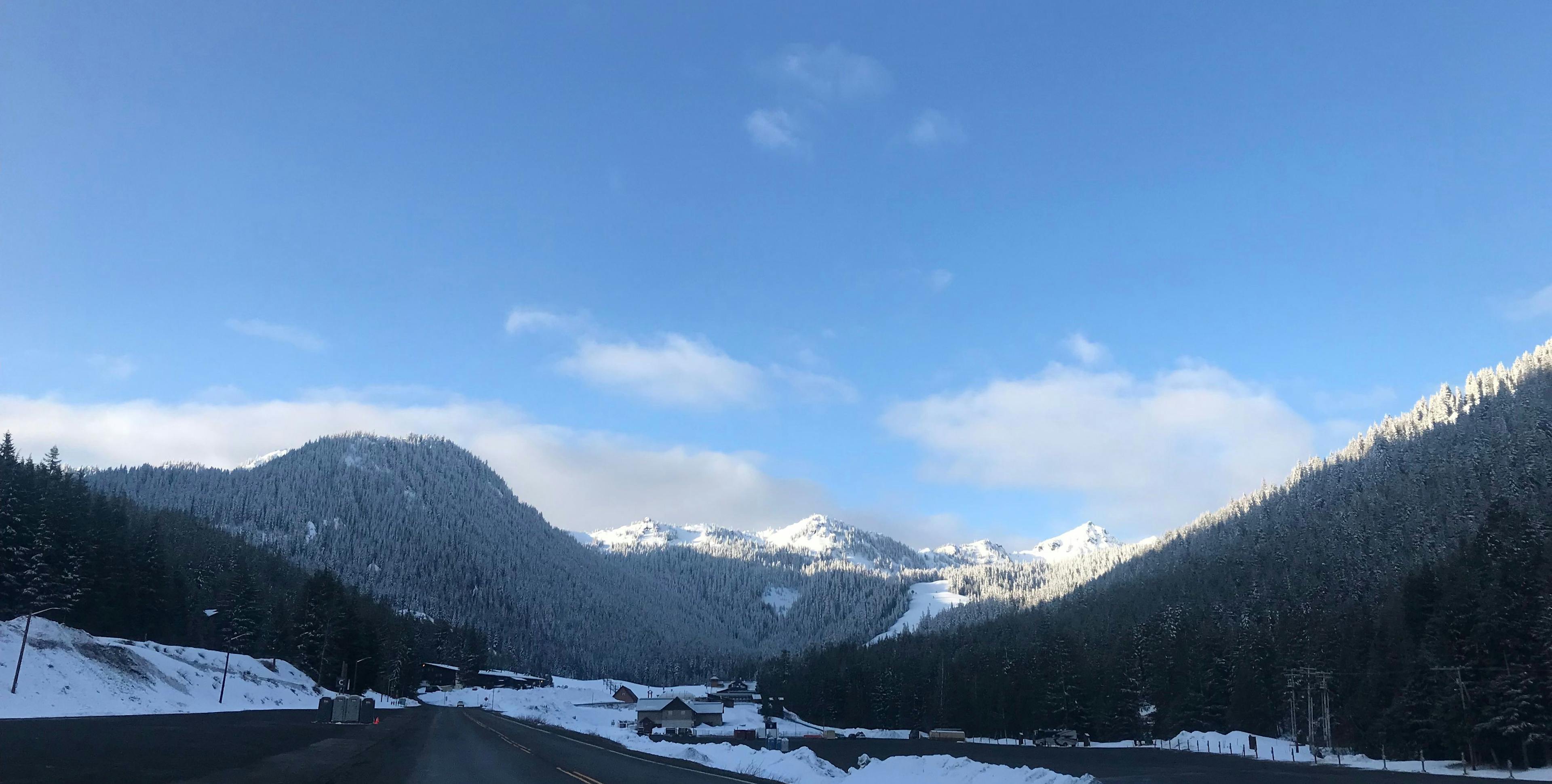
While the technical source of the Wenatchee River is Lake Wenatchee, its flow fluctuations are mostly due to melting snow and accumulating rainfall. With a watershed that includes 12 sub-basins (smaller tributary watersheds), the Wenatchee River receives water from as far away as Buck Creek of the Chiwawa River. As the snow melts from the ridgelines surrounding Leavenworth, Cashmere, and beyond, the Wenatchee fills and gives rise to some of the rapids that we know as Gorilla, Rock’n’Roll, and (perhaps appropriately named) Snowblind.
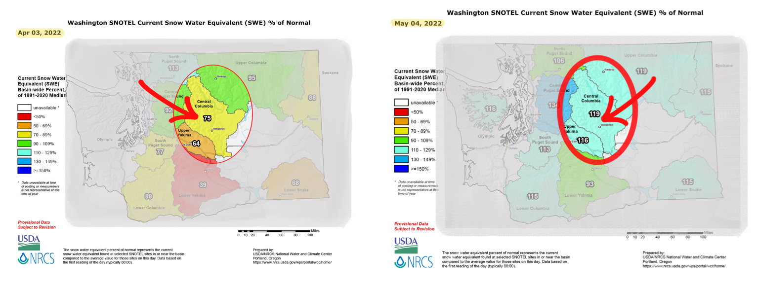
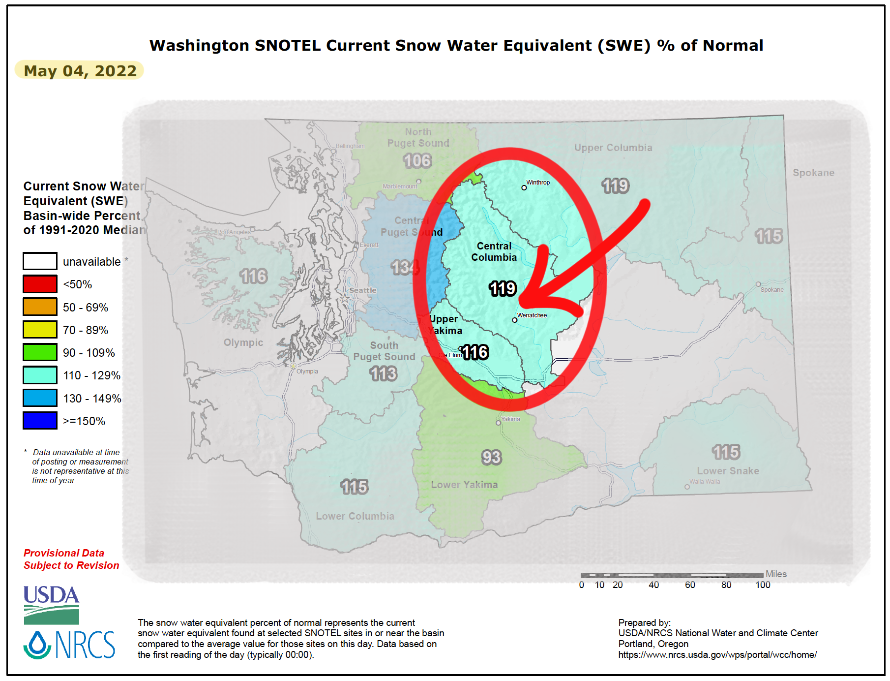
While the snowpack was looking a little sparse at the beginning of April, we have been encouraged as a whitewater community by the unexpected end-of-season storm that swept through our ridgelines. We are (as of May 5, 2022) sitting at 119% of the “usual” snowpack. This is great news, but you might be wondering what exactly that means. This is where it gets a little more scientific and a little less “snow is water, water is river, river is rafting, rafting is fun”.
The calculation of the “usual” snowpack data comes from a variety of Snow Telemetry (SNOTEL) sites located throughout Washington. These SNOTEL sites provide critical information about winter weather, including snow depth and snow to water equivalent (SWE). Snow depth is simply how deep the snow is on the ground, and if you’ve ever taken a ruler out and measured the snow in your backyard, you’ve performed a snow depth measurement! Because snow can be of different densities (think wet, heavy slush versus light, powdery flakes), the depth of snow alone is not enough information to make judgments about how much moisture is in the snowpack. This is where SWE comes into play. SWE is simply the amount of water contained within the snow; it answers the question, “If all of this snow had been rain, how much rain would have fallen?” For rivers, this gives us some indication of how much flow is stored up in the mountains.
The “usual” snowpack refers to the median SWE at that site for the past 30 years, also called the Period of Record. The current Period of Record is 1991 to 2020. The percentages that appear on the map are calculated by comparing the daily SWE measurements at each SNOTEL site to the median SWE of the Period of Record. Thus, we infer that the 119% that we see on the map on May 4, 2022, indicates that the SWE of that specific date is 19% greater than the median from 1991-2020. For more information and explanation on SWE and what those percentages mean, check out the resources below.
The moral of this snow story is that we are delighted by our current snowpack and looking forward to getting on the Wenatchee now and (hopefully) for a long while into the summer. The usual adage of “April showers brings May flowers” should prove true for our Wenatchee season, though instead of blooming flowers we’re excited about blossoming flows. We may have questioned that surprise April snowstorm, but current data gives us reason to be grateful for all the snow we shoveled unseasonably late in the winter season.
__________________________________________________________________________________________________________________________________________________
Bibliography
Montgomery Water Group, Inc. . “Wenatchee Planning Watershed Assessment Maps.” County of Chelan Natural Resources, 11 Feb. 2015.
Nowlin, Mark, and Seatte Times graphics staff. “Tracking Washington State's 2021-22 Snowpack through Maps and Charts.” The Seattle Times, The Seattle Times Company, 2 May 2022.
Reppenhagen, Cory. “How Snowpack Is Measured and How to Read the Map.” 9News , KUSA-TV, 20 Dec. 2019.
“Wenatchee River Watershed.” Washington Department of Health.
“What Is Snow Water Equivalent.” United States Department of Agricultural Natural Resources Conservation Service.